Sometimes the weathermen are right! Congratulations to the great forecast put out by the National Weather Service, nailing this storm. At 9:00PM the rain turned to snow, just as they predicted. The snow is still falling as I write this, but I'm hearing rumors of 15" in Fort Collins, I had about 10" in Boulder and it was coming down in buckets when I left for work, and Denver has maybe 5" so far. Here's a few pictures of the beautiful first snow.
 |
| My poor little rain gauge is that yellow thing sitting on the left chair buried under the snow. |
 |
| Bus stop in Boulder |
 |
| The line for Obama. I between the Science building and North Classroom looking west. |
 |
| Line for Obama stretching around the Science building, looking east. |
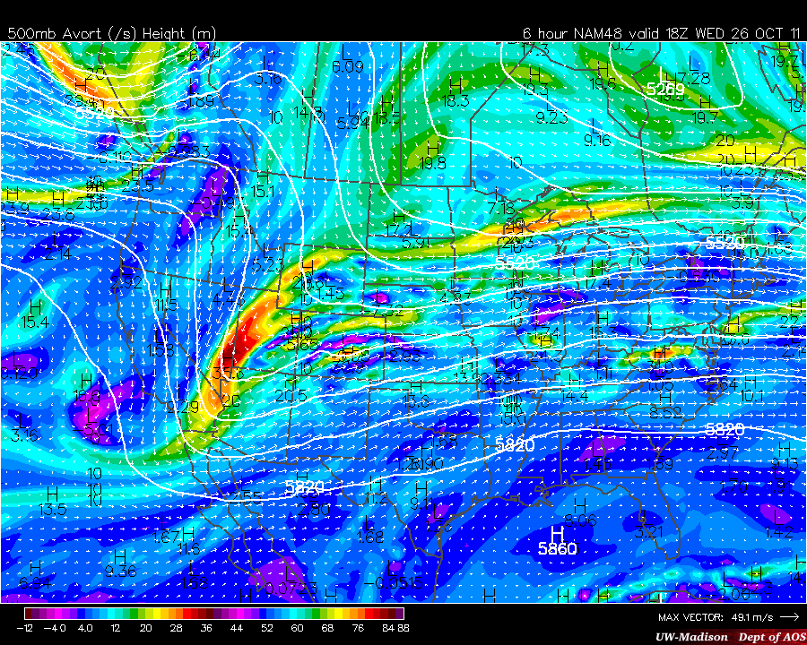
Lastly, here's this morning's 18Z (noon) forecast from the 12Z run of the NAM. I use my undergraduate university's weather page, since that's how I first learned how to forecast. However, similar maps can be found other places.
University of Wisconsin AOS page or
NCAR RAL
A top-down view.
 |
| 300 mb winds are shaded showing a split jet. The right entrance region and left exit region of the jet will help enhance upward vertical motions, leading to snow. |
 |
| The 500 mb heights and vorticity shades are showing the trough axis still west of us. |
 |
| 850 mb temperatures and heights. (Boulder sits at 830mb). The strong color gradient (green areas) are showing the position of the cold front that moved through last night, bringing us a new air mass. (Remember, it was 79 degrees on Monday, which was the record high for that day.) This also shows wind vectors, which have an easterly component over us, due to the counterclockwise winds associated with the low pressure over the four corners and the clockwise high pressure in Wyoming. |
 |
| Surface sea level pressure contours and precipitation shades as well as yellow dotted lines for 1000-500mb thickness. The forcing for this storm was upper level, but the clockwise rotation of the high pressure (anticyclone) north of us and the counterclockwise rotation of the low pressure (cyclone) southwest of us are enhancing the easterly component of the wind, leading to upslope. |
Let it snow! (Until tomorrow, when I have to fly to Fresno, CA for the 7 Revolutions conference!)